WRAL: Thousands lose power west of Triangle in rain
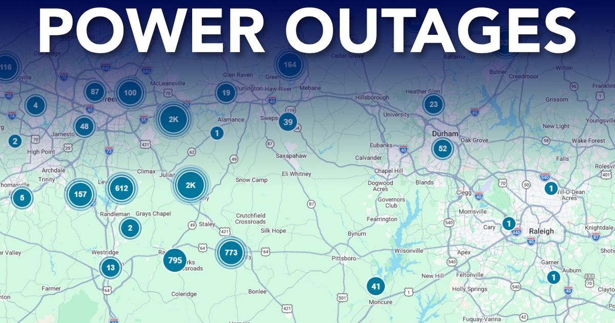
Thousands of Duke Energy customers lost power west of North Carolina's Triangle on Thursday morning as heavy rain knocked down trees and limbs. WRAL reported roughly 2,000 outages in Durham, more than 2,500 in Chatham County's Siler City area, and over 8,000 around High Point, where the National Weather Service clocked more than six inches of rain.
Key Takeaways
- Duke Energy showed about 2,000 customers without power in Durham by 6:30 a.m. Thursday.
- More than 2,500 Chatham County customers were dark around Siler City at 6 a.m., with outages into Randolph County.
- High Point topped 8,000 outages after more than six inches of rain, per the National Weather Service.
- A flood advisory covered Wake, Durham, Chatham, Orange, Person, and Granville counties Thursday morning.
- Fallen trees and limbs damaged equipment; some Chatham outages carried an estimated restoration as early as 7:45 a.m.
Where were the worst WRAL-tracked outages?
According to WRAL, Durham was among the hardest-hit Triangle-area pockets, with Duke Energy's outage map showing around 2,000 customers offline at 6:30 a.m.
A smaller Garner outage left 168 customers without power near West Garner Road and Weston Road after a fallen tree. Another tree came down in Raleigh at Millbrook Road and Ivy Lane.
West of the metro core, more than 2,500 Chatham County customers in Siler City were without power at 6 a.m. Outages stretched into Randolph County communities including Staley and Liberty. Many failures were tied to trees or limbs hitting equipment, with an estimated restoration as early as 7:45 a.m. for that cluster.
The High Point area reported more than 8,000 outages as of 6 a.m., underscoring how far the storm's power impacts reached beyond Durham alone.
How much rain fell, and where is flooding most likely?
The National Weather Service in Raleigh said more than six inches of rain had fallen in High Point by 5 a.m. Thursday. Burlington, Greensboro, and Winston-Salem also saw several inches.
WRAL meteorologist Elizabeth Gardner said between one and three inches had already fallen in the Triad, with more rain still expected. Station meteorologists said rain bands would slide southward through Thursday, after some of the heaviest totals already soaked areas west of the Triangle in Durham and Chatham counties.
A flood advisory was in effect Thursday morning for Wake, Durham, Chatham, Orange, Person, and Granville counties, meaning flooding was likely. Areas southeast of the Triangle such as Smithfield and Goldsboro could see the worst flooding later Thursday, WRAL noted.
For readers following radar and alert tools in our Future Tech & AI Wonders coverage, WRAL pointed audiences to DualDoppler5000 tracking and its weather app for ongoing alerts as bands continue to move.
What should drivers and residents do during the outages?
WRAL News was already receiving reports of ponding on roads Thursday morning. The North Carolina State Highway Patrol repeated a life-saving message: "Turn Around, Don't Drown." Even shallow water can be dangerous.
Storms Thursday were expected to drop several inches of rain across central North Carolina. Flooding remained the biggest overall risk even as outages mounted from fallen trees and limbs damaging equipment.
As restoration continues from Durham and Chatham into Randolph County and High Point, drivers should heed the Highway Patrol warning and avoid flooded roads while rain bands keep sliding south.