Winter storm batters West with snow, rain and 50-foot waves
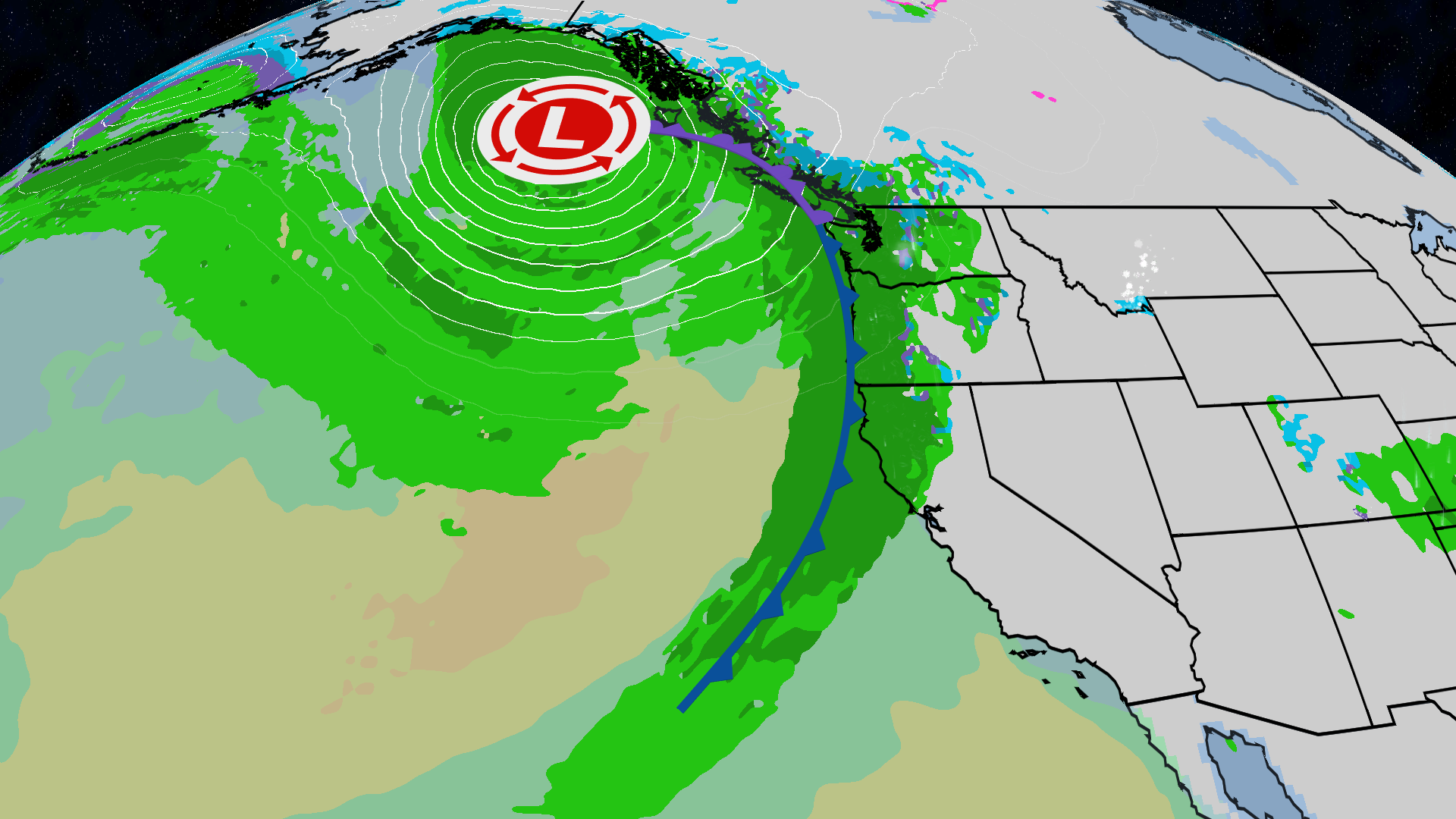
A winter storm series fueled by an atmospheric river will batter the West Coast into next week with heavy mountain snow, soaking rain and waves that could reach 50 feet from Northern California to Oregon, according to The Weather Channel. Travel hazards, coastal danger and more Sierra snow are already underway.
Key Takeaways
- Pacific storms will march through the West well into next week with rain, wet mountain snow, gusty winds and dangerous surf.
- Rainfall of 3–6 inches is expected in southern Oregon, far Northern California, the northern Sierra foothills and Washington’s Olympic Peninsula.
- Nearshore waves may hit 30 feet and break to 50 feet from Northern California to the Oregon coast through early Sunday.
- Palisades Tahoe reported 10 inches mid-mountain from the first round, with two more snowstorms expected this week.
- Northern California chain controls can cut Interstate 80 to 30 mph and Highway 50 to 25 mph when snow piles up.
For more forecast-tech and science coverage, browse Future Tech & AI Wonders on BlasterPost.
When will the winter storm hit the West Coast?
According to The Weather Channel, a quick-hitting series of Pacific storms will bring rounds of rain, heavy wet mountain snow, potentially damaging waves and gusty winds well into next week. The systems are fueled by an atmospheric river.
By Sunday morning, heavy rain and high-elevation snow were expected to hit parts of Washington, Oregon and Northern California, then spread from the Bay Area to western Montana by evening. Monday’s focus shifts inland toward the Intermountain West, with higher-elevation snowfall chances rising in the Sierra Nevada and Rockies. Another storm approaches midweek, with Wednesday’s heaviest rain and mountain snow centered on the Sierra Nevada as cooler air lowers snow levels.
How much rain and mountain snow are expected?
Rainfall totals of 3–6 inches are forecast in southern Oregon, far Northern California, the northern Sierra Nevada foothills and Washington’s Olympic Peninsula. Lower totals over an inch are likely from the Bay Area to western Washington and Oregon. The Weather Channel said this first stronger system of the season should largely bring beneficial rain, though later storms may raise flooding and debris-flow risk near wildfire burn scars.
Sierra snowfall over 2 feet is possible by week’s end, with difficult travel from high snowfall rates, low visibility and strong winds. At Palisades Tahoe, the first round delivered 5 inches at the base and 10 inches mid-mountain—within the lower end of the forecast. Resort meteorologists expect Sunday night into Monday to add roughly 2–6 inches near the base, 5–9 mid-mountain and 6–11 up top, with a colder Wednesday–Thursday storm that some model runs, including the GFS and its AI version, suggest could dump 2–3 feet if forecasts hold.
Why are coastal waves so dangerous this weekend?
Through early Sunday, the strongest system could produce nearshore waves as high as 30 feet, potentially breaking to 50 feet at favored spots from Northern California to the Oregon coast. Heightened surf continues into Monday, with another smaller bump midweek. Rip currents and sneaker waves will be above average early in the week, and the risk of drowning in coastal waters is very high this weekend.
The National Weather Service in Medford, Oregon, urged mariners to remain in port, secure vessels and monitor forecasts. High tides combined with elevated water levels from El Niño could create multiple feet of coastal flooding. Coastal debris, including evergreen logs, can become projectiles in cresting waves and has killed or seriously injured beachgoers in the past, NWS Portland noted.
What should Northern California drivers watch for?
KCRA reported Northern California’s first of three forecast storm systems had arrived, with an Impact Day issued Friday for rain, wind and snow effects on travel. When enough snow falls, chain controls take effect: Interstate 80’s speed limit drops to 30 mph, and Highway 50 drops to 25 mph. Sierra travelers should expect difficult conditions as additional winter storm rounds push through the week.
Behind the first pulse, Palisades Tahoe noted clearer, colder weekend skies before precipitation returns Sunday evening. Drivers and coastal visitors should check official forecasts before heading out, as timings remain subject to change.