Tornado Chicago warning hits as storms pound suburbs
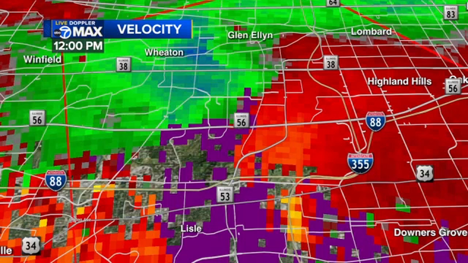
A tornado Chicago warning covered parts of Cook and Will counties Monday afternoon after radar showed rotating storms, while severe thunderstorm alerts flagged risks of damaging wind and large hail. Extreme heat with indexes near 100 to 110 raised health stakes as cooling centers stayed open.
Key Takeaways
- The National Weather Service issued a tornado warning at 12:10 p.m. Monday after radar showed rotation near west suburban Downers Grove.
- ABC7 Chicago reported the tornado warning covered Cook and Will counties until 1:15 p.m.; a DuPage County warning was canceled.
- Storms were capable of 70 mph wind gusts and up to two-inch hail, with quarter-size hail reported in Clarendon Hills.
- Heat indexes of 100 to 110 and a heat advisory compounded risks as Chicago cooling centers remained open.
- A second round of storms and localized flooding remained possible later Monday afternoon and evening.
According to ABC7 Chicago, severe weather spawning tornado warnings moved through the Chicago area Monday afternoon, with ground stops in effect at O'Hare and Midway.
What areas faced a tornado Chicago warning Monday?
The Chicago Sun-Times reported the National Weather Service urged residents to stay weather aware after issuing storm warnings Monday morning. The tornado warning, issued at 12:10 p.m., followed radar signs of tornado-capable storms and rotation in Downers Grove.
Storms were moving southeast at about 30 mph. The warning was in effect until 1:15 p.m. in parts of Cook, Will, and DuPage counties, the Sun-Times said. ABC7 later noted a DuPage County warning had been canceled, while Cook and Will remained under the alert until 1:15 p.m.
A Severe Thunderstorm Warning was also in effect for Cook, Lake, and Will counties in Illinois and Lake County, Indiana, until 1:30 p.m., ABC7 reported. An earlier severe storm warning covered northern Cook County, Lake County, northeastern Kane County, and southeastern McHenry County until 1 p.m., according to the Sun-Times.
What storm hazards were reported across the suburbs?
Radar indicated rotation near the Darien area around 12:15 p.m., and the storm was moving near Orland Park by about 12:38 p.m., ABC7 said. Quarter-size hail was reported in suburbs such as Clarendon Hills, with potentially baseball-size hail in Bolingbrook.
The Chicago area was under tornado and severe thunderstorm warnings as storms capable of producing 70 mph wind gusts and two-inch hail moved across northern Illinois, the Sun-Times reported. National Weather Service meteorologist Scott Baker said lightning was the primary hazard with earlier storms and warned that being outside would be hazardous.
A second round of storms with an even higher chance of damaging wind was possible later Monday afternoon and evening, Baker said. Heavy rainfall could lead to localized flooding, and a flash flood warning was issued until 4 p.m. Monday.
How does extreme heat raise health risks during storms?
Even as storms passed, extreme heat persisted. Heat index values in western parts of the Chicago area could exceed 110, with more than 100 elsewhere, ABC7 AccuWeather meteorologist Tracy Butler said. The region remained under a heat advisory, and an Extreme Heat Warning covered DeKalb, Grundy, La Salle, and Livingston counties until 9 p.m. Monday.
For readers tracking heat stress and recovery habits in our Longevity & Biohacking coverage, Monday's combination of severe storms and dangerous heat underscored basic safety: get indoors when thunder starts, limit outdoor exertion, and use cooling centers if needed.
Chicago cooling centers were open during standard hours, with libraries, Park District facilities, police stations, and senior centers also available for relief. Residents can call 3-1-1 to request well-being checks. A cold front was expected overnight, bringing cooler temperatures in the low 80s on Tuesday, Baker said.