Odds rise again for a super El Niño by fall, NOAA says
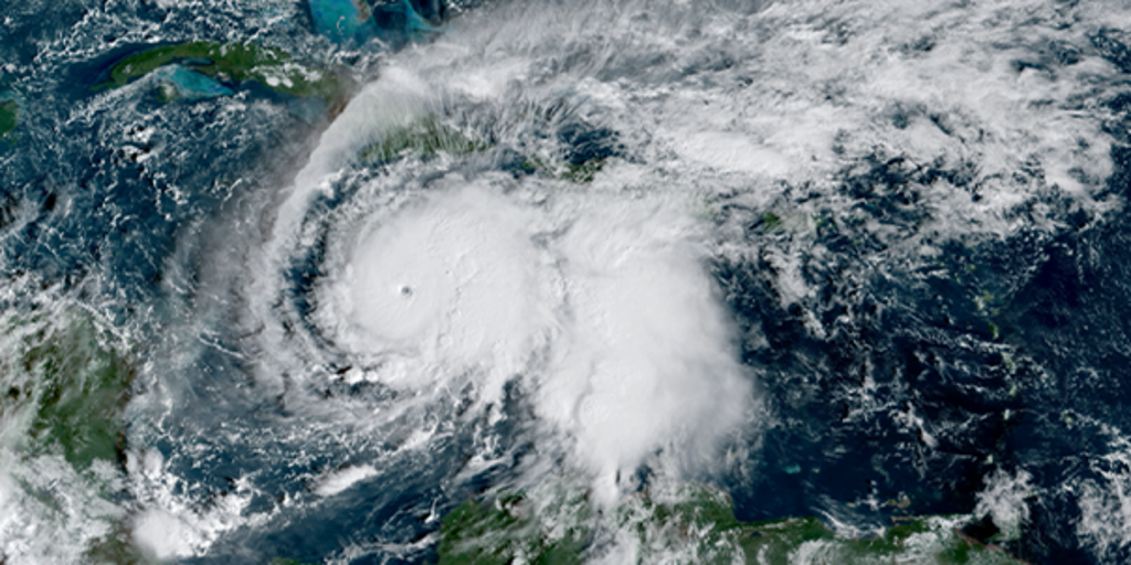
NOAA now gives an 81% chance that El Niño will reach "very strong" strength by fall 2026, up from 63% in June — putting a potential super El Niño on track to rank among the most intense events since 1950. The biggest U.S. impacts are expected this fall and winter.
The Climate Prediction Center's July update sharpened what forecasters have been watching for months: a Pacific warming pattern that formed only last month is already moderate, strengthening fast, and showing little sign of slowing. With a 97% chance El Niño persists into next spring, governments and residents across the U.S. are bracing for a winter shaped by one of nature's most powerful climate drivers.
Key Takeaways
- NOAA raised the odds of a very strong El Niño by fall to 81%, up from 63% in June.
- A super El Niño could rival or exceed the 1997–98 event — among the strongest since 1950.
- The southern U.S. faces higher odds of a rainier winter; the North may see warmer conditions.
- Strengthening El Niño is suppressing Atlantic hurricane activity during peak season.
- California may see wetter winter odds, but past strong events have missed rainfall targets.
Why are forecasters raising super El Niño odds again?
In its latest monthly outlook, NOAA said ocean temperatures in key parts of the equatorial Pacific are at or near record highs for this time of year. That heat builds on long-term ocean warming from human-caused climate change, amplifying a pattern that skipped the weak stage and jumped straight to moderate strength.
The odds of a very strong event by October climbed to 81%, a sharp jump from the 63% figure in June's forecast. Forecasters say the event could rival the 1997–98 El Niño, and some models suggest it could become even stronger. The Climate Prediction Center also sees a 97% likelihood that El Niño conditions will linger through early spring 2027.
What could a very strong El Niño mean for U.S. weather?
El Niño is nature's heat-releasing thermostat — a natural warming of equatorial Pacific waters that redistributes temperature and rainfall worldwide. Its heaviest impacts typically arrive in the Northern Hemisphere's fall and winter months, according to AP News.
For most of the southern United States, a very strong El Niño increases the chances of a rainier winter. Northern states and Canada face higher odds of warmer-than-normal winter conditions. A top-tier event does not guarantee more extreme weather everywhere, but it tilts the odds toward droughts, downpours, and heat waves in regions where El Niño typically leaves its mark.
How is El Niño affecting the 2026 Atlantic hurricane season?
El Niño's influence on the Atlantic is already visible. Colorado State University lowered its 2026 hurricane forecast again, citing the high potential for a very strong El Niño during the season's peak. The pattern increases hostile upper-level wind shear across the tropical Atlantic, creating conditions that suppress hurricane formation and organization.
One month into the season, only one named storm had formed — a quiet start that forecasters link directly to the strengthening Pacific pattern. NOAA's outlook still calls for a below-normal Atlantic season, though experts warn it only takes one landfalling storm to make any year dangerous. For more on how climate systems reshape forecasts, see our Future Tech & AI Wonders coverage.
Will California see a wetter winter?
In California, El Niño tips the odds toward a wetter winter, especially across the southern half of the state. NOAA also notes increased chances of higher Sierra Nevada snowpack, intensified Eastern Pacific hurricane activity, coastal flooding from rising seas, and stress on marine ecosystems already battered by Pacific heat.
History offers a cautionary note. The 2015–2016 "Godzilla" El Niño — one of the strongest on record — failed to deliver the soaking rains Southern California expected. Meteorologist Jan Null told SFGATE that higher odds of a very strong event do not tell us what the actual impacts will be. As the Pacific continues to warm, the one certainty forecasters agree on is that this El Niño bears close watching through fall.