Severe thunderstorm warning issued amid Pennsylvania storm risk
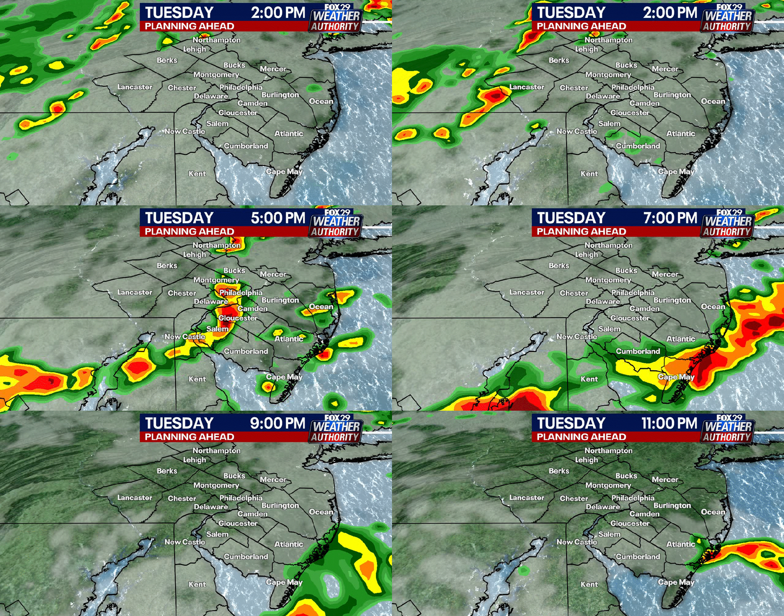
A severe thunderstorm warning and related watches have put parts of Pennsylvania on alert Tuesday, with flash flooding, damaging winds, and isolated tornado risks from the Philadelphia area to Western Pennsylvania. Officials warn of heavy rain, wind gusts up to 70 mph, and multiple storm rounds through evening. Residents from Philly to Pittsburgh should monitor alerts and avoid flooded roads as conditions shift through Tuesday night.
Key Takeaways
- A tornado watch covers portions of Pennsylvania, New Jersey, and Delaware through Tuesday night, with wind gusts possible up to 70 mph near Philadelphia.
- Western Pennsylvania counties including Allegheny, Beaver, Fayette, Greene, Washington, and Westmoreland are under a severe thunderstorm watch until 8 p.m.
- Flash flood warnings and a broader flood watch highlight heavy rain risks, especially near and south of I-70.
- Forecasters expect two storm rounds, with the strongest activity roughly 1–5 p.m. and a weaker scattered round later.
What is under a severe thunderstorm warning today?
In Western Pennsylvania, meteorologists reported the day's first severe thunderstorm warning for communities from New Castle and Ellwood City through much of Beaver County toward Zelienople and Cranberry Township. That warning covered damaging-wind potential as storms moved east from eastern Ohio near Canton at about 65 mph.
The National Weather Service also placed Allegheny, Beaver, Fayette, Greene, Washington, and Westmoreland counties in a severe thunderstorm watch until 8 p.m., according to WTAE. A prior warning had expired by late afternoon updates, but the broader watch and flood threats remained active.
Why does flash flooding matter for the Philadelphia and Pittsburgh areas?
FOX 29 Philadelphia reports another mid-Atlantic severe weather event Tuesday, with heavy rain and a tornado possibility around Philly. Portions of Pennsylvania, New Jersey, and Delaware are under a tornado watch through Tuesday night.
Near Pittsburgh, a flash flood warning for Washington and Greene counties ran until 6 p.m. after Doppler radar showed thunderstorms dumping about 1 to 1.5 inches of rain, with another 1 to 2 inches possible. Impacts include flooding of small creeks, urban streets, highways, underpasses, and other low-lying or poor-drainage areas. A flood watch covers Allegheny, Armstrong, Beaver, Butler, Fayette, Greene, Indiana, Washington, Westmoreland, and Monongalia counties until 11 p.m.
Emergency guidance is simple and familiar: turn around, don't drown. Most flood deaths occur in vehicles.
When will the strongest storms hit, and how severe could they get?
WTAE called Tuesday a Severe Weather Alert Day, with the region in a level 3 of 5 risk for severe thunderstorms. Damaging winds lead the threat list, followed by a few tornadoes and large hail. The greatest flash-flood risk is near and south of I-70.
Two rounds are expected. The strongest line is timed about 1 p.m. to 5 p.m.; a second round from around 6 p.m. should be more scattered and less intense. Lingering showers may continue into the first half of the night before cooler, less humid air arrives midweek.
FOX 29 also noted an afternoon lull that could help fuel stronger storms later—another reason to keep checking radar and watches rather than assuming the threat has passed. For readers tracking outdoor routines and recovery habits during extreme weather, see BlasterPost's Longevity & Biohacking hub for related wellness coverage.
Highs near Pittsburgh were forecast around 81°F on the storm day, with cooler and breezier weather Wednesday as storms exit.