Santiago gets lighter rain as third front hits Coquimbo
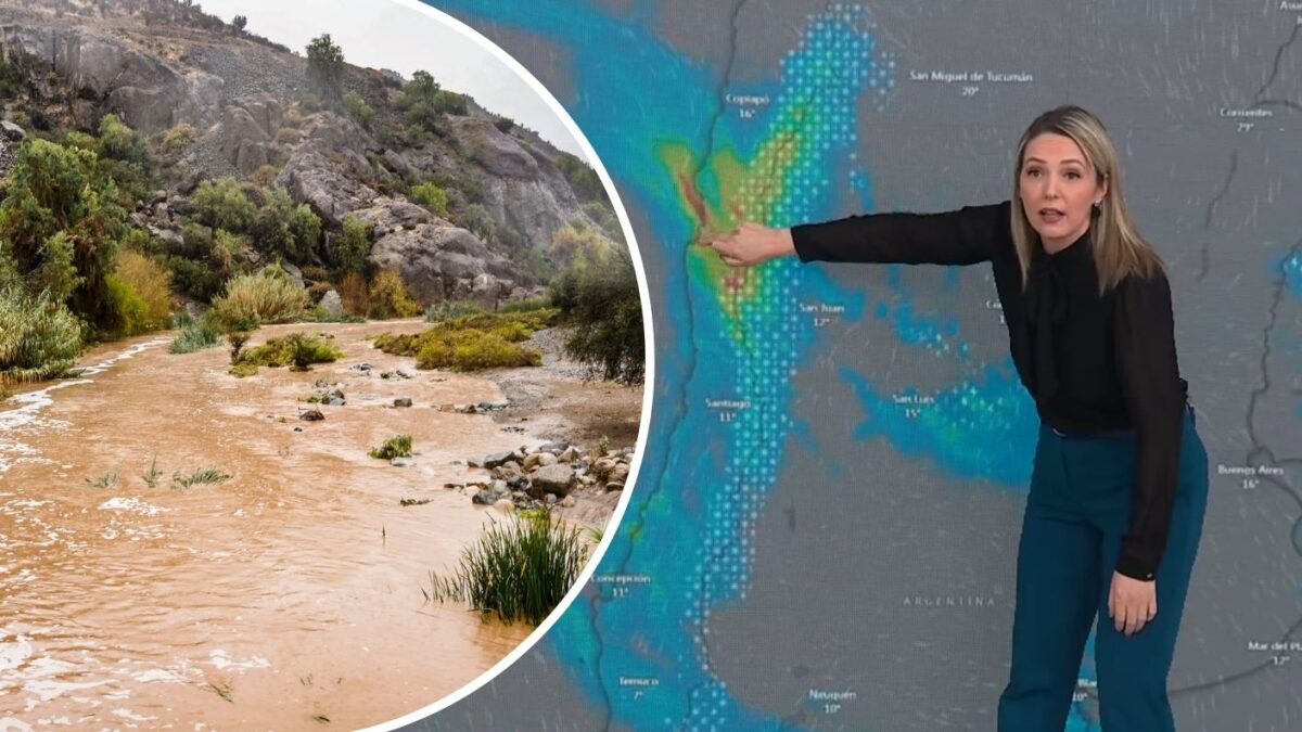
Chilevisión meteorologist Allison Göhler says a third frontal system will mainly intensify over Coquimbo and nearby norte chico areas, while Santiago and the Metropolitan Region should see a weaker impact. The front may begin Sunday evening, strengthen Monday, and last through about Wednesday, July 22.
Key Takeaways
- Allison Göhler warns the third front starts weak then intensifies, especially along the coast and again in Coquimbo.
- Santiago faces a more moderate hit; the heaviest focus remains Coquimbo, southern Atacama, Valparaíso, and coastal O’Higgins.
- Inland Coquimbo communes such as Salamanca, Monte Patria, Combarbalá, and Ovalle remain high-concern zones.
- Separate forecasts point to more fronts later in the week, keeping central Chile’s rain pattern unsettled into late July and August.
While much of Chile is still dealing with the current frontal system, Göhler told CHV Noticias AM that another train of rain is lining up for the centro-norte. She reviewed multiple weather models and said the Metropolitan Region, including Santiago, would feel a milder pulse than the norte chico corridor.
That matters because soils are already wet after days of heavy rain. Even a moderate reload raises concern on saturated ground, which is why local timing and intensity still deserve close attention.
When does the third frontal system arrive?
According to the models Göhler reviewed, the third system should begin showing up between Sunday afternoon and night, gain strength on Monday, and could stretch into Wednesday, July 22.
“Va a empezar débil, pero después va a intensificarse principalmente en el sector costero y nuevamente en la región de Coquimbo,” she said. In plain terms: a soft start, then a sharper coastal and Coquimbo punch.
Universidad de Talca meteorologist Patricio González, speaking to Radio Agricultura, separately warned that new fronts could arrive between July 20 and 23, with rain possibly continuing through late July and an August that “se ve bastante complicado.”
Which zones will feel the strongest rain?
Göhler said the system now over Chile is still dumping its heaviest effects on the Coquimbo Region, especially interior communes. For the incoming third front, she again flagged Coquimbo as the main concentration zone, plus the southern part of Atacama, Valparaíso, and coastal O’Higgins.
“En la región Metropolitana nos afectaría un poco más débil,” she noted, underscoring that Santiago should not be the peak impact area this time. Towns such as Salamanca, Monte Patria, Combarbalá, and Ovalle sit among the inland spots of greatest concern.
Full model details and quotes are in the Chilevisión report.
Will more fronts keep soaking Santiago and central Chile?
Meteored Chile’s Laura Batista projects four frontal systems for central Chile in the coming week. She expects a quieter Saturday pause for the Metropolitan and Valparaíso regions, then rain returning Tuesday, July 21, with Santiago receiving roughly 10 to 15 mm in that first midweek event alone.
Later pulses include a weaker Thursday system toward Biobío, a Friday system paired with a category 1–2 atmospheric river, and a stronger Sunday, July 26, front with coastal winds up to 80 km/h. González also linked the broader unsettled pattern to a strengthening El Niño.
If you are adjusting outdoor training, recovery sleep, or travel around storm days, keep checking official forecasts—and browse related wellness context in our Longevity & Biohacking section.