San Francisco weather sparks dual waterspouts over the Bay
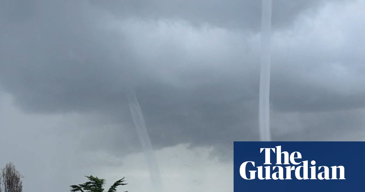
Two waterspouts formed over San Francisco Bay during Monday's severe storm, a rare sight confirmed by the National Weather Service as tornado warnings, hail, and more rain hit the region. San Francisco weather remains unsettled for several days, with further thunderstorms and coastal flood risks ahead.
Key Takeaways
- Two waterspouts appeared over San Francisco Bay amid Monday's rare severe storm, with video captured near Candlestick Point.
- The National Weather Service confirmed the waterspouts in a special marine warning and tracked a tornado warning along the Santa Cruz coast.
- Hail hit parts of the East Bay, while heavy rain, high winds, and coastal flood advisories are expected to continue for several days.
- Waterspouts are uncommon in the Bay Area compared with the Great Lakes and south-east Florida, according to federal storm data.
What happened over San Francisco Bay on Monday?
Observers recorded a pair of waterspouts spiraling above the bay as storms pummelled the region. Social media footage showed the twin vortices cutting a sheer streak into the sky, delighting and shocking viewers.
Jordan Perkins-Lewis filmed one waterspout from Visitacion Valley, saying the feature was near Candlestick Park. NBC Bay Area also reported waterspouts spotted near Candlestick Point, with hail reported inland in Richmond. KRON4 said no damage was caused by the waterspout.
Why does this San Francisco weather event matter?
Waterspouts are vortexes of air and water mist that the NWS compares to tornadoes over water. Sightings are not common for the Bay Area, though they are more prevalent in the Great Lakes and along south-east Florida's coast, according to The Guardian citing federal storm data.
Fair-weather waterspouts are usually weaker, while tornadic waterspouts can pose a risk to boaters and coastal areas if they move onshore. NWS guidance says the safest response is to move at a 90-degree angle to a waterspout's apparent path and never stand close to one.
The same volatile day brought a tornado warning after NWS tracked a severe thunderstorm capable of producing a waterspout about 10 miles west of Santa Cruz. Pacific Elementary School staff sheltered students indoors, away from windows, as a massive dark formation approached from the horizon.
How long will the stormy conditions last?
Inclement weather is forecast to continue for a few more days. An NWS outlook called for rain on Tuesday with potential thunderstorms on Wednesday and Thursday. A high wind advisory ran until early Wednesday morning, and a coastal flood advisory covered early Wednesday through Thursday morning.
Most of the Bay Area is expected to see 1.5 to 3 inches of rain, with northern counties up to 4 inches and the Santa Cruz mountains predicted at 5 inches. East Bay Hills gusts could reach 70 mph. Elevated tides raise coastal flooding risk through at least Thursday, while the Sierra Nevada may get about 4 feet of snow, possibly making mountain travel impossible midweek.
Forecasters link California's wetter winter pattern to Super El Niño, raising storm and flood risks statewide. For outdoor wellness routines tracked on our Longevity & Biohacking hub, the practical takeaway is simple: treat marine warnings seriously and keep workouts inland until the system clears.
After Thursday evening, showers may subside, with some rain lingering over the Pacific and nearby inland communities.