Philadelphia's rare weather gift after heat and storms
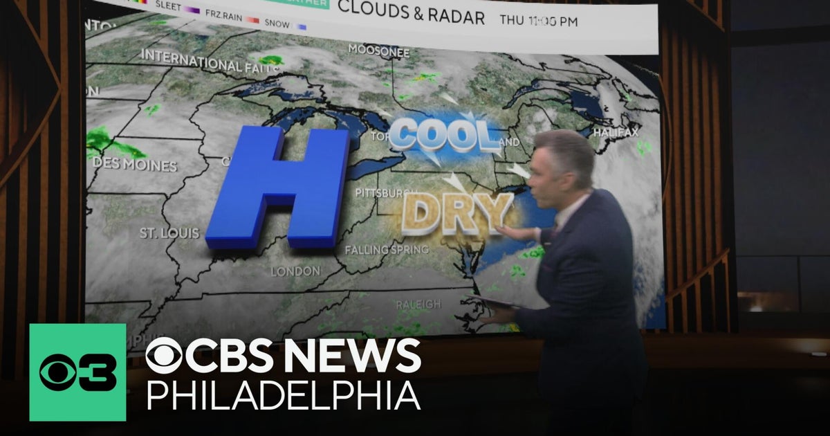
After weeks of heat, storms, and stifling humidity, the Philadelphia region has finally scored a weather gift: several near-perfect summer days with near-average temperatures and little to no rain—the first such stretch in about two months. Cooler, drier air across the Northeast and Midwest is also giving air conditioners—and household energy bills—a rare midsummer break.
Key Takeaways
- Philadelphia has gone roughly two months without four straight near-average, rain-free days—until this calm stretch arrived after weeks of heat and storms.
- South central Pennsylvania is under strong high pressure, with sunny skies, low humidity, and highs around 82°F—below the late-July average of 86–87°F.
- Much of the Midwest and Northeast can ease off the A/C for a few days as dew points fall into the 40s and 50s and wildfire smoke thins.
- Overnight lows in the 50s (and 60s along the Boston-to-D.C. corridor) make open-window cooling a real option for many homes.
- The pleasant pattern fades early next week as humidity and thunderstorm chances return across Pennsylvania.
Why does this weather gift matter for your wallet?
Summer comfort usually means the thermostat and the power bill rising together. This midsummer reset is different. The Weather Channel notes that households across the Midwest and Northeast can give hard-working air conditioners a rest for the next few days after a torrid stretch of heat, humidity, and choking wildfire smoke.
That break is not just about comfort. Cooler nights and drier air let many people open windows overnight and in the morning instead of running cooling systems nonstop. Senior meteorologist Jonathan Erdman framed it plainly: the pause can spare both your A/C and your wallet, while also delivering cleaner outdoor air than last week's smoke-heavy cool-down.
If you track household cash flow the way readers of BlasterPost wealth hacks and passive income often do, treat these few days as a small, real-world energy save—not a permanent rate cut, but a rare July window when nature does part of the cooling work for free.
What happened before this perfect stretch arrived?
Context explains why the calm feels so sharp. According to CBS News Philadelphia, it has been about two months since the city enjoyed four straight days with near-average temperatures and no rain. Local coverage described the turn as perfect summer weather after weeks of heat and storms.
Nationally, July's first weeks were punishing even by midsummer standards. The Fourth of July week heat wave brought New York City its first 100-degree high in 14 years and cooked the July 4 World Cup match in Philadelphia. Another intense heat dome later seared the Northern Plains, with triple-digit highs into the Dakotas and Minnesota.
That heat helped spark wildfires in Ontario and northern Minnesota. The resulting smoke was the most intense since at least 1999 in parts of the Midwest and East. The Weather Channel reports the first three weeks of July ranked among the hottest on record for parts of the East, Midwest, and Northern Plains—enough, as Erdman put it, to make an A/C cry uncle.
How good is the forecast across Pennsylvania right now?
In south central Pennsylvania, WGAL describes a tranquil close to the week under strong high pressure. Skies turned sunny, humidity stayed low, and temperatures felt comfortable for late July. Overnight readings were expected to fall into the upper 50s to lower 60s, with light winds and decreasing cloud cover.
Thursday was forecast near 82 degrees—below the seasonable average of about 86–87 degrees—with light winds and mostly sunny skies. Friday and Saturday were expected to mirror those refreshing conditions. Forecasters called it a pleasant stretch to get outdoors, with low humidity and no rain in sight until the start of next week.
Farther east, CBS News Philadelphia's forecast package framed the same idea for the metro region: a rare run of near-average, rain-free summer days after a two-month dry spell of that pattern. Combined with the broader Northeast cool-down, inland highs in the 70s to low 80s and comfortable nights are the kind of late-July setup residents usually wait all season to enjoy.
Along the Boston-to-D.C. corridor, overnight lows in the 60s still count as relief after recent muggy heat. Inland Midwest and Northeast spots may even see lows in the 50s. Dew points in the 40s and 50s signal comfortably dry air, a sharp contrast with the sweat-inducing dew points in the 70s that dominated recent weeks.
When does the cooler, drier pattern end?
Enjoy it while it lasts. WGAL says isolated thunderstorms can arrive late Sunday across portions of the Valley, with storm chances rising Monday. The next best chance of widespread showers and thunderstorms looks to fall on Tuesday, with another round of showers and isolated storms possible Wednesday.
Humidity is then expected to linger through the following Thursday, with temperatures staying in the low-to-mid 80s under partly sunny skies. That timeline lines up with the wider Northeast picture: a few days of open-window weather, then a return toward more typical muggy summer conditions.
The Weather Channel also cautions that hotter weather is expected to trend into the Plains and parts of the Midwest this weekend into next week. Wildfires in northern Minnesota and central Canada are still burning, though recent rain, cooler weather, and firefighting have reduced smoke for now. Another smoke episode later this summer cannot be ruled out.
How can households make the most of a short weather gift?
Think of this as a short utility window, not a new climate baseline. Cross-ventilate at night and early morning while dew points stay low. Scale back daytime A/C if indoor temperatures stay comfortable. Use the dry, sunny stretch for outdoor errands, laundry, or projects that usually fight humidity—then button up before early-week storms return.
None of that replaces longer-term bill strategies, but it matches what meteorologists are actually offering this week: a few days when cooler, cleaner air does free work that your compressor usually pays for. After a historic early-July heat wave, weeks of storms, and a wildfire-smoke scare, Philadelphia and much of the Northeast finally got the midsummer reset they were waiting for.
Sources: CBS News Philadelphia; WGAL; The Weather Channel.