NYC weather: How much rain hits Thursday and Friday
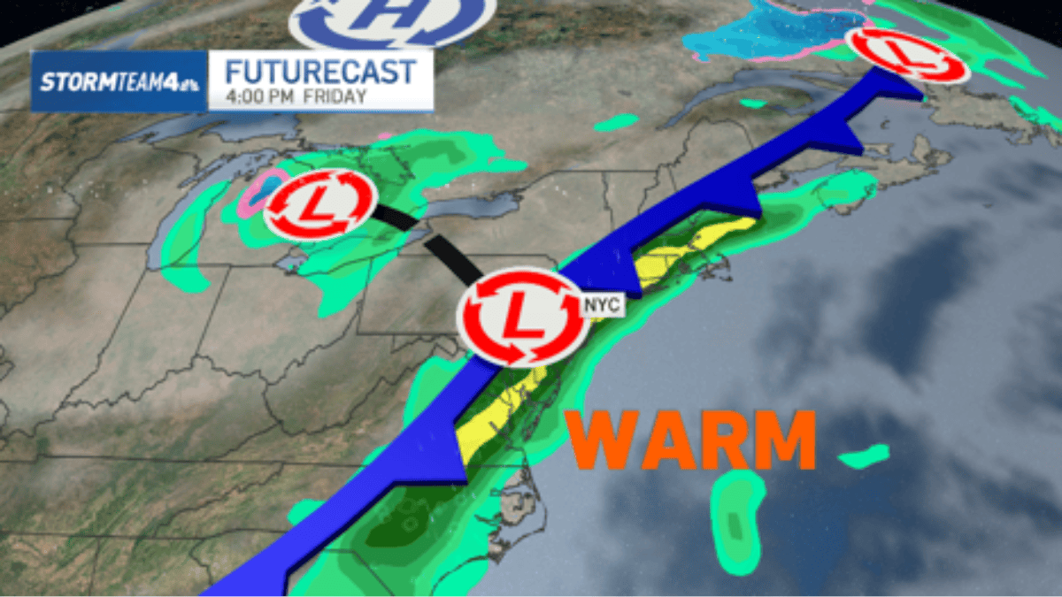
NYC weather is turning wetter as the region's longest dry stretch of the year ends. Scattered showers arrive Thursday, with heavier rain Thursday night into Friday. Inland areas should see well under a half inch, while Long Island and the Jersey Shore could pick up 2–3 inches or more if the heaviest band clips the coast.
Key Takeaways
- The tri-state's longest dry stretch of the year ends Thursday as a cold front approaches.
- Thursday brings light, scattered showers; Friday is the main umbrella day along the coast.
- Inland rainfall should stay well under a half inch; coastal totals remain highly uncertain.
- Long Island and the Jersey Shore could see 1–3 inches, with flash flood risk in heavier cells.
- A cooler, mostly dry weekend follows, with highs in the upper 50s to mid 60s.
According to NBC New York's Storm Team 4, showers start Thursday morning well ahead of the front. Rain will not fall all day, and any showers should stay light—though packing an umbrella is still the safer call.
By Thursday night into Friday morning, the cold front drapes along the East Coast with a band of deep atmospheric moisture ahead of it. Rain with embedded thunder is expected to greet the immediate coast Friday morning and continue on and off through the day.
How much rain can the NYC area expect?
Inland spots are not forecast to catch organized heavy bands, so totals there should remain meager—well under a half inch in most places. The coast is the wild card.
The American forecast model shows heavy rain barely clipping the coast, which could mean Long Island and the Jersey Shore pick up as many as 2–3 inches or more on Friday. The European model tracks that heavy rain completely offshore, keeping coastal totals closer to inland amounts.
National Weather Service guidance cited by Patch points to 1–2 inches along the Jersey Shore, with locally higher amounts of 2–3 inches possible. The rest of New Jersey may see a trace to an inch. Exactly where the heaviest totals line up depends on where the front stalls.
Will there be flooding or severe storms?
Forecasters do not anticipate severe weather Friday. Isolated flooding remains possible if communities get clipped by the heaviest downpours.
Because rain has been scarce, roads may turn slippery quickly. AccuWeather Senior Meteorologist Brett Anderson warned that this setup can lead to flash flooding when heavier rain cells repeatedly move over the same areas.
Thursday timing also varies by location. NWS notes that western portions of the forecast area see rising rain chances through Thursday, while areas along and east of the metros stay primarily dry with a 30% chance of precipitation or less until Thursday night into Friday.
What does the weekend look like after the rain?
The cold front moves out Saturday, leaving mostly dry conditions, though a spotty shower cannot be ruled out. Temperatures turn noticeably cooler.
Highs settle in the upper 50s to mid 60s, with overnight lows in the 40s for most. Cooling continues Sunday into early next week, with highs in the upper 50s to low 60s and overnight lows in the 30s for most areas—40s in the metro.
For more market and lifestyle coverage beyond the forecast, browse BlasterPost's Net Worth & Wealth hub.