Nino is now stronger than any point in 1,000 years
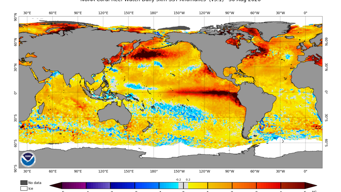
A new coral-based study finds El Niño in the eastern Pacific is stronger than at any point in the last 1,000 years, with temperature swings since 1984 running far above the preindustrial baseline. Scientists link the surge to human-driven warming, as a looming super nino raises stakes for weather worldwide. The research, detailed by Ars Technica, uses fossilized Galápagos corals and climate models.
Key Takeaways
- Eastern Pacific El Niño variability since 1984 runs about 36.5% higher than from 1000–1850 CE.
- Positive skewness shows warmer El Niño peaks—not cool swings—got stronger.
- Natural-only climate models almost never produce a jump this large without human warming.
- A developing super El Niño could reshape Himalayan summer heat and western U.S. snow.
What did the coral study find about El Niño?
University of Michigan environmental scientist Julie Cole and colleagues reconstructed roughly a thousand years of eastern Pacific ocean temperatures from Galápagos corals. The islands sit where the strongest eastern ENSO events hit hardest, and few other near-equatorial islands exist nearby.
Corals grow one to two centimeters a year. Their calcium carbonate skeletons record water chemistry through strontium-to-calcium ratios and oxygen isotopes that track temperature. Living colonies cover recent decades and can be checked against instruments. Dead coral heads, dated with uranium-thorium methods, push the timeline back toward about 1100 CE across 28 series from five islands.
Set against that baseline, the modern era looks extreme. Temperature variability since 1984 is 36.5% higher than the preindustrial stretch from 1000 to 1850 CE and still 16.2% higher than 1851–1982. Events that once ran a degree or two above normal in the Galápagos now run three or four. Cole said the skewness turned positive, meaning warmer events got stronger. Neither the Little Ice Age nor the Medieval warm period left a comparable ENSO fingerprint.
Is human warming behind today’s stronger nino?
ENSO can surge on its own, so the team compared coral results with last-millennium climate simulations that included volcanoes and solar changes but not rising greenhouse gases. The observed increase sat outside the models’ internal variability at nearly 99% confidence—evidence the recent eastern Pacific surge would be highly unlikely without human influence.
“We are attributing that to warming, and we know what causes the warming, and it’s our use of fossil fuels,” Cole said. Central Pacific Line Islands corals show a murkier signal, but models expect forced change to emerge first in the east, matching the Galápagos record.
Two more strong El Niño events have arrived since the coral logs ended, and another is developing that Cole and many experts expect could break records. She called it a new style of El Niño, not a fluke.
Why does a looming super El Niño matter now?
Global warming is already expected to intensify ENSO’s wet and dry extremes because warmer air holds more moisture. Stronger temperature swings would compound those hydrological risks.
Scientific American reports experts watching a looming super El Niño after Himalayan debris floods that have killed more than 1,000 people. Classic El Niño often means warmer Himalayan summers and a drier monsoon, raising melt and slope risks, though scientists cannot yet say whether the brewing event shaped the recent disaster.
In the U.S. West, Sacramento Bee analysis of climate models and NOAA’s Climate Prediction Center outlook points to a wetter California winter and a warmer, often drier Pacific Northwest. Sierra snowfall looks above average in model runs—especially in January—though warmth may lift the rain-snow line and delay early-season snow. Follow related coverage on BlasterPost’s Streaming & TV Alerts hub.