NASA NISAR satellite reveals Antarctica ice hummingbird
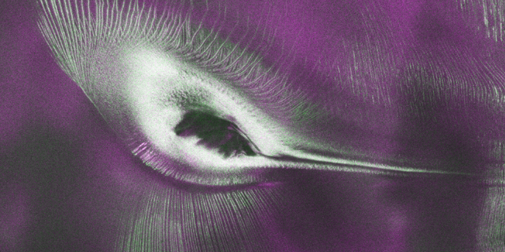
A NASA NISAR satellite Antarctica radar image shows what looks like a hummingbird under East Antarctic ice — but it is Nunatak Zaterjavshijsja, a real mountaintop in a glacier stream. U.S.-India L-band radar mapped crevasses and subsurface ice structure optical photos miss, as public NISAR science data began flowing in July 2026.
Key Takeaways
- NISAR L-band radar imaged Nunatak Zaterjavshijsja in East Antarctica, a mountaintop that resembles a hummingbird.
- Green marks crevasses from glacier stress; magenta marks smoother ice returning horizontally polarized signals.
- Public access to NISAR radar data began July 20, 2026, ahead of the mission's first launch anniversary.
- Unlike optical photos, radar can penetrate snow and ice, revealing how the glacier is moving beneath the surface.
What did the NASA NISAR satellite find in Antarctica?
According to NASA's Jet Propulsion Laboratory, an early image from the U.S.-India NISAR mission captures a fractured Antarctic icescape that, by chance, looks like a hummingbird in flight.
The feature is Nunatak Zaterjavshijsja, a mountaintop in East Antarctica poking out amid ice flowing northeast toward the ocean. As the glacier passes the obstruction, mountain topography stresses the ice and fractures surrounding surfaces into deep crevasses, shown as sharp green lines.
Fox Weather and USA Today both note the same NASA finding: the "bird" is geology and ice dynamics, not wildlife. Magenta areas represent more regular surfaces such as smooth ice, while green traces volume scattering from irregular faces like crevasse walls.
Why can NISAR see what optical satellites miss?
Seongsu Jeong, the JPL signal analysis engineer who produced the image, said radar can often see through snow and deep into ice, observing fundamentally different properties than optical imagery. A Landsat 9 view of the same scene is almost entirely white, with only slight shadows and texture hints of the mountaintop.
NISAR transmits horizontally polarized microwave signals over Antarctica. Returns that stay horizontal appear magenta; vertically polarized returns, linked to refraction or scattering in the ice, appear green. White marks places where both surface and volume scattering come back strongly.
The hummingbird scene was generated from L-band measurements gathered in August 2025 while U.S. and Indian teams tested the satellite's systems. Jeong called it beautiful and scientifically rich, offering insights into how the glacier is moving.
When did NISAR open its radar data to the public?
As of July 20, 2026, the public can access data from NISAR's two powerful radar instruments. U.S. teams started continuous release of calibrated L-band products for measurements collected since June 17, distributed via the Alaska Satellite Facility Distributed Active Archive Center in Fairbanks.
NISAR launched July 30, 2025, from India's Satish Dhawan Space Centre. The mission monitors nearly all land- and ice-covered surfaces twice every 12 days and produces on the order of dozens of terabytes of science data a day. It is the first free-flying satellite to carry both L-band and S-band synthetic aperture radars.
NASA says the release helps researchers track land and ice motion, monitor forests and wetlands, and respond to hazards such as landslides and earthquakes. For more BlasterPost alerts across our feeds, visit the Fintech & Crypto Alerts category hub.