Hurricane Fausto strengthens to Category 2 near Hawaii
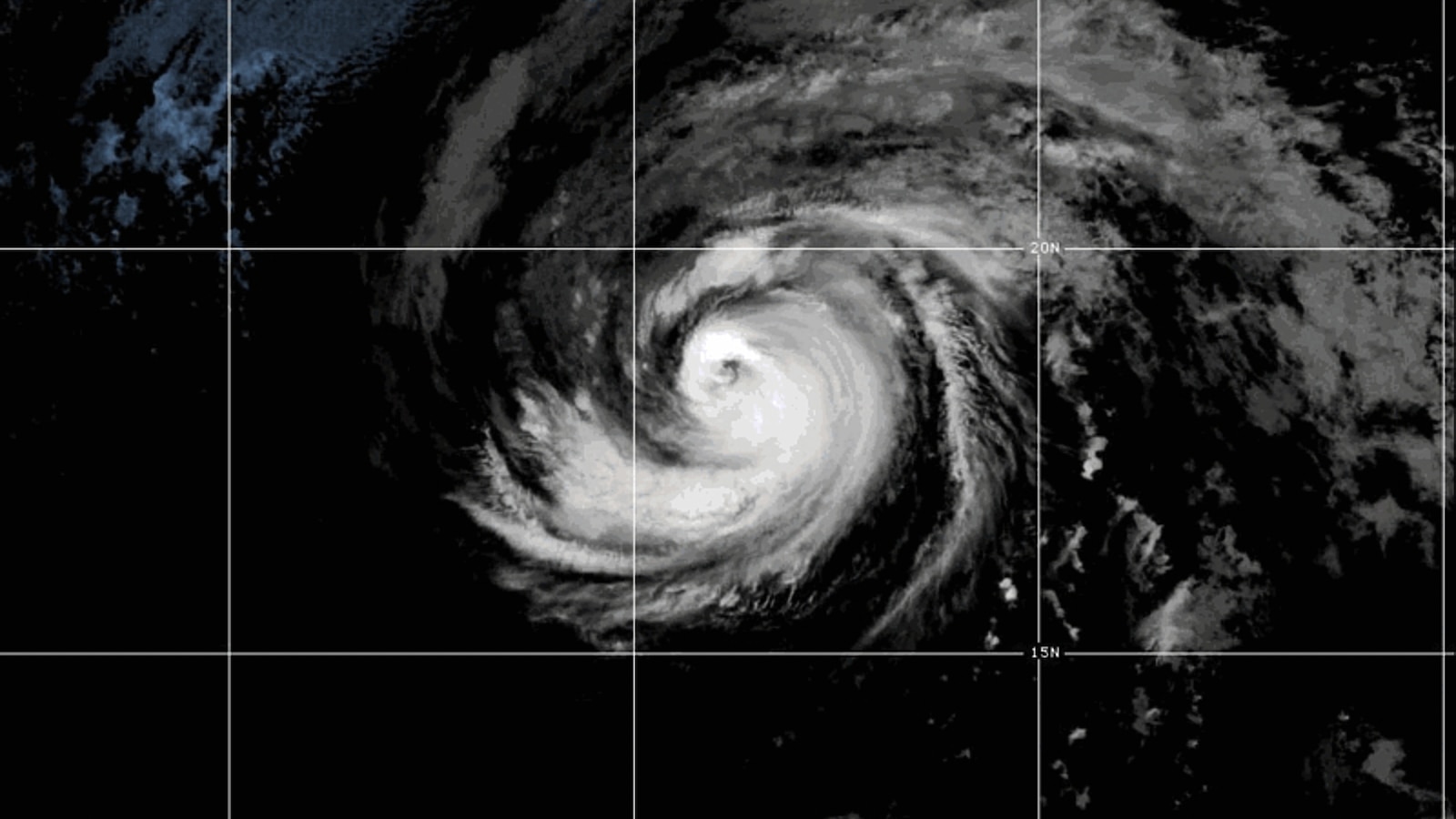
Hurricane Fausto has strengthened into a Category 2 storm in the Pacific Ocean and is expected to approach the Hawaiian Islands next week, forecasters said. The National Hurricane Center says wind and rainfall risks are rising, though exact impacts remain uncertain as the system stays far from land.
Key Takeaways
- Hurricane Fausto reached Category 2 strength Friday with maximum sustained winds near 100–105 mph.
- The storm is forecast to approach Hawaii next week; island interests should monitor updates.
- Cooler waters and dry air are expected to weaken Fausto before it arrives, possibly to a weak tropical storm or remnant low.
- Swells from Fausto could bring life-threatening surf and rip tides to parts of southern California.
- Tropical Storm Genevieve formed Friday and may rapidly intensify into the East Pacific’s first major hurricane of 2026.
According to AP News, Fausto was still far from land Friday—roughly 1,385 miles east of Hilo, Hawaii—while the National Hurricane Center in Miami warned that the risk of some wind and rainfall impacts is increasing. It is too soon, the center said, to pin down the exact location or magnitude of those effects.
ABC News, citing the same forecast guidance, placed the hurricane about 1,300 miles west of the southern tip of Baja California and about 1,600 miles east of Hilo, with sustained winds around 100 mph. AP reported peak winds near 105 mph as Fausto held Category 2 intensity.
Where is Hurricane Fausto now, and how strong is it?
Friday updates described a storm already at Category 2 strength and still over open Pacific waters. FOX Weather reported that Fausto peaked as a Category 2 on Friday while moving through the eastern Pacific and drawing attention toward Hawaii.
Gradual weakening is expected in the coming days. Cooler ocean waters and intensely dry air along the path toward Hawaii are forecast to sap the storm’s power, according to the FOX Forecast Center.
Will Hurricane Fausto hit Hawaii next week?
Forecasters expect Fausto to approach the Hawaiian Islands next week, and the National Hurricane Center advised that interests there should monitor its progress. By the time the system reaches the islands, models suggest it may be a very weak tropical storm—or even a remnant low—if it holds together at all.
If remnants persist, Hawaii could see heavy rain and high surf on east- and northeast-facing beaches. FOX Weather said impacts could begin Tuesday night into Wednesday, though forecasts may change as Fausto moves closer. For more storm-track context and related coverage, see our Future Tech & AI Wonders hub.
What else is happening in the Pacific with Genevieve?
Tropical Storm Genevieve formed Friday as Tropical Depression Seven-E rapidly strengthened. The National Hurricane Center located Genevieve about 570–585 miles south of Zihuatanejo, Mexico, with maximum sustained winds around 50 mph.
Genevieve is expected to intensify quickly and is forecast to become the first major hurricane of the 2026 eastern Pacific season. Current tracks keep it over open water, posing no threat to land—including Hawaii. Separately, Tropical Storm Bertha had already dissipated after bringing heavy surf and some flooding to southern Louisiana and Texas.
Bottom line: Hurricane Fausto is a Category 2 system headed toward Hawaii’s neighborhood next week, but weakening is favored before arrival. Stay tuned to official National Hurricane Center advisories for the latest path and impact details.