Houston weather: Friday storm alert as flood risk rises
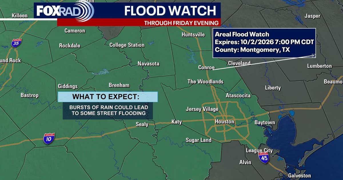
Houston weather is under a Friday storm alert and flood watch after heavy rains hit areas west and northwest of the city Thursday night. Expect more rounds of rain through the weekend, with the highest flood risk west of Houston and totals of 1 to 3 inches across most of the metro.
Key Takeaways
- A FOX 26 Storm Alert and Flood Watch remain in effect through Friday evening for Houston-area counties.
- Thursday night storms dumped 4 to 6 inches in spots near Cypress, Waller, and western Montgomery County.
- Space City Weather issued a Stage 1 flood alert for areas west of Highway 59/I-69 on Thursday night.
- Most of the Houston area could see 1 to 3 inches of rain through the weekend as storms continue.
- Officials urge drivers and pedestrians to avoid flooded streets and low-lying areas.
What is happening with Houston weather right now?
Thursday’s main heavy rain largely stayed west of central Houston, but the flood risk rises Friday as storms move in. According to FOX 26 Houston, the metro is under a Storm Alert through Friday night, with rounds of heavy rain that could flood streets—especially west and northwest of the city.
Walker, Grimes, Montgomery, Waller, Harris, Wharton, Fort Bend, and Jackson counties were added to a Flood Watch until 7 p.m. Friday. Places such as College Station, Brenham, Sealy, and Columbus were expected to be among the hardest hit over the next day.
How much rain fell Thursday night west of Houston?
Space City Weather reported that thunderstorms tied to a slow-moving front edged farther east than forecast Thursday evening. Most rainfall totals were in the 1 to 2 inch range, but some locations near Cypress and Waller picked up about 4 inches, and parts of western Montgomery County saw 4 to 6 inches.
By about 8:15 p.m., storms stretched roughly from Katy north to The Woodlands. Forecasters said the line could push as far east as Highway 59 before easing around midnight, with another 1 to 2 inches possible in spots already getting rain. Street flooding was the main concern behind the Stage 1 flood alert west of Highway 59/I-69.
Will storms continue through the weekend?
Click2Houston meteorologists say Houston faces several rounds of rain and thunderstorms through the weekend as a front approaches. Most areas could pick up 1 to 3 inches, with higher amounts where storms repeatedly train over the same spots. Central Texas could see 3 to 6 inches or more.
Friday brings another round of storms, with coverage increasing later as the frontal boundary nears. The strongest storms could produce gusty winds and frequent lightning, and a few near the front could drop small hail. By Saturday and Sunday, FOX 26 says the focus shifts toward the coast and areas east of Houston. Early next week, highs in the middle 80s and overnight lows in the 60s offer a slight taste of fall.
For more science and forecasting coverage across our Future Tech & AI Wonders hub, stay tuned as local alerts are updated.