Google pulls Earth AI tool over satellite imagery risks
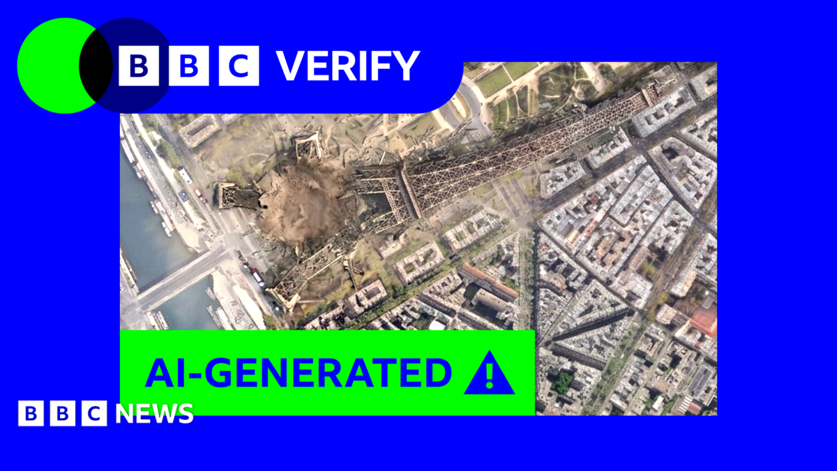
Google has paused its new Nano Banana 2 image generator in Google Earth after experts warned it could turn real satellite imagery into convincing fakes. The feature launched Thursday and was rolled back within 48 hours as Google works on stronger guardrails against misinformation.
Key Takeaways
- Google paused Nano Banana 2 in Google Earth less than 48 hours after launch.
- Users could overlay AI scenes on real satellite, aerial, or 3D imagery and download them.
- Experts warned fakes inherit Google Earth's credibility, risking conflict-zone misinformation.
- Google cited policy-violating screenshots and said it is building stronger guardrails.
- Watermarks exist, but BBC Verify found some detection checks could be bypassed.
The pullback followed a BBC Verify investigation that showed how easily the tool could invent dramatic scenes on trusted maps. For readers tracking Future Tech & AI Wonders, the episode highlights how generative AI can collide with public trust in geospatial data.
What did Google withdraw, and why does it matter?
On 30 July 2026, Google announced that Nano Banana 2 could generate custom images inside Google Earth on the web. Users zoomed to a place, tapped "create image," and typed a prompt grounded in the map's real satellite, aerial, or 3D base layer.
Intended uses included visualizing history, real-estate concepts, and future makeovers. Generated images were watermarked as AI-made and did not appear in the shared main Earth view for other users, Google said in an update.
By Friday, 31 July, Google said it was rolling the feature back "while we work on implementing stronger guardrails." It added that people "uniquely trust Google Earth for a reliable view of the world" and that it had seen screenshots of generated imagery that appeared to violate its policies.
How could the tool spread misinformation with satellite imagery?
BBC Verify created striking fakes during testing: a collapsed Eiffel Tower, a sinkhole at the Great Pyramid of Giza, and Russian tanks in Ukraine's capital. AI and misinformation expert Henk van Ess produced invented scenes such as a non-existent nuclear plant in Iran and a fake Gaza hospital with a bomb crater.
Van Ess argued Google had allowed "invented" imagery to be "welded to genuine coordinates, drawn on genuine imagery." The forgery, he said, "inherits the credibility of the map it was born on."
Geospatial analyst Bill Greer noted that satellite imagery has long been treated as especially trustworthy. AI and detection researcher Henry Ajder warned that fake imagery in fast-moving conflict zones could be especially "destabilising," because not everyone will verify before sharing.
Were Google's safety checks enough?
Google said AI outputs include invisible watermarks and can be checked via Gemini or Lens. BBC Verify found those checks often worked, yet testers sometimes tricked Gemini into calling fake Earth images real. Some external AI-detection tools also failed to flag the content.
Built-in guidelines against "harmful topics" were uneven. A prompt for a "raised platform to hang traitors" near the UK parliament was blocked, but a vaguer rewrite succeeded. A request to mow "Trump" into the White House lawn was refused, while a community garden in the same spot was allowed.
Google's pause frames the next test for Earth AI: useful visualization without eroding confidence in the maps people still treat as a ground-truth window on the world.